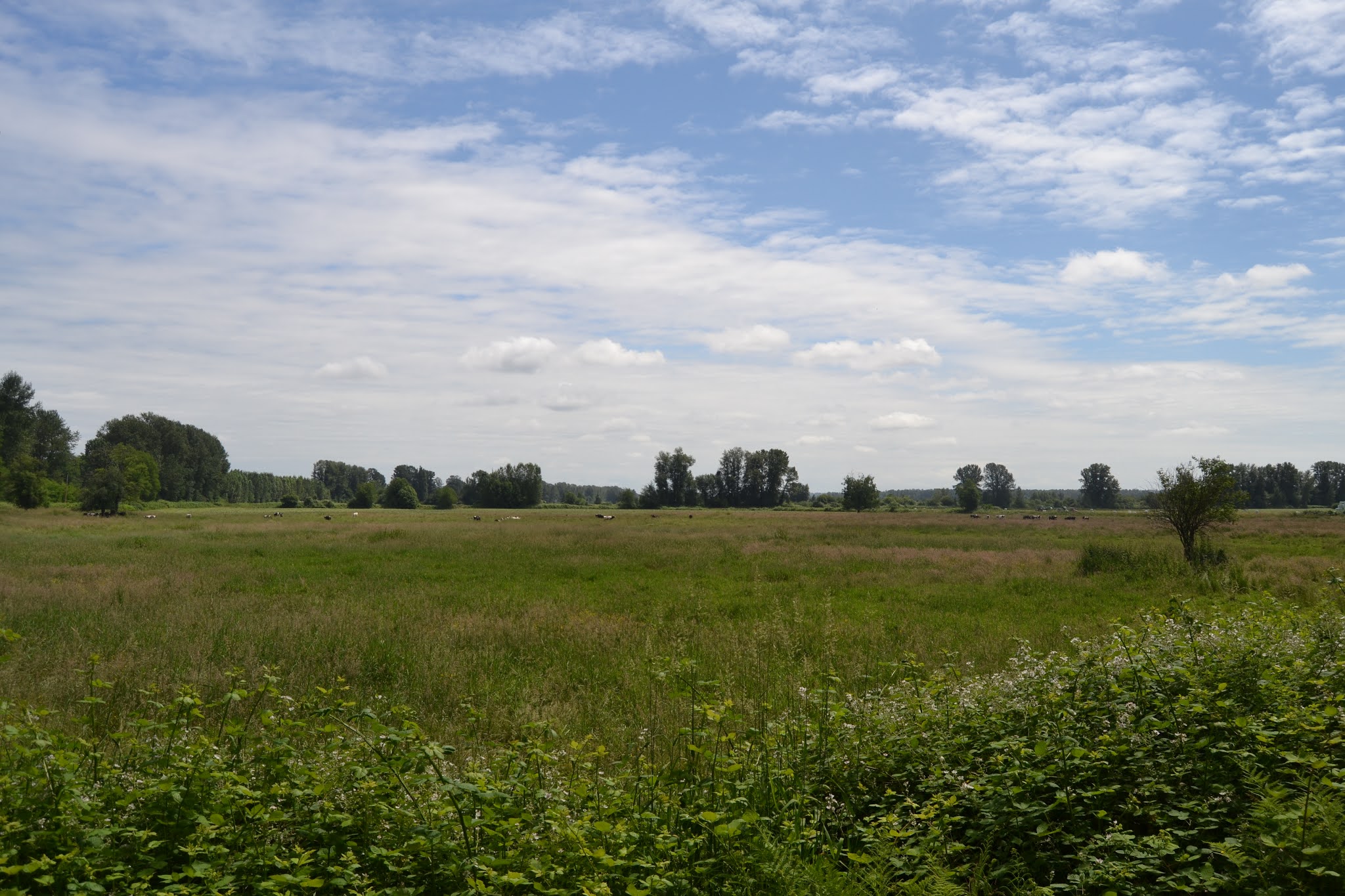
on aug 19 i rode my bike from my home in KERRISDALE at 12 noon and heaed for the BRIGEPORT CANADA LINE STATION. when i got there i got onto the BIKE BUS for 1pm and went to 52nd st and HWY 17 . when i got to 52nd street at HWY 17 i got off the bus there in front of the TSAWWASSEN MILLS MALL and acrossed HWY 17 and went south on 52nd street to 12ave wich i had go up a very big hill wich got me to 12 ave. from there i went east long 12 ave along the way i could see BOUNDARY BAY in the distance . when i reach the end of 12 ave at BOUNDARY BAY RD i got onto the BOUNDARY BAY PARK and its pathway for bikes and walkers. as i was on the pathway i saw a viewing spot were you can great great view of BOUNDARY BAY looking towards WHITE ROCK SOUTH SURREY and the border at PEACH ARCH. so after that i went long the path wich is in BOUNDARY BAY PARK wich is a METRO VANCOUVER PARK and took me all the way to CENTENNIAL BEACH wich is in BOUNDARY BAY PARK the beach was crowed and wile i was rideing long the pathway i saw viewing towers to see the birds in the bay . when i got to CENTENIAL BEACH i got onto CENTENNIAL PARKWAY and went all the to 3 ave were i saw acess to the beach next to a gated housing place when i got onto the beach i saw the border and POINT ROBERTS less than mile away and saw the end of BOUNDARY BAY . then after i left the beach near the border i went long 3rd ave and onto BOUNDARY BAY RD wich i never seen this part of TSAWWASSEN in very long time and has changed alot with gated houseing. when i got to the end of BOUNDARY RD it got me back onto 12 ave and all the way to 52nd street but i stoped at 12 ave and 56th st wich is a major street in TSAWWASSEN for a drink and rest stop. after that i went long 12 ave and got back onto 52nd st and down the hill and onto HWY 17 were i got to the bus stop to catch the bike bus back to BRIDGEPORT STATION wich i did . from there i got to BRIDGEPORT STATION onto the CANADA LINE to LANGARA WEST 49TH STATION and rode home from there. and got home at 4.10.pm overal the ride in TSAWWASSEN was great and only took 15 min from HWY 17 to BOUNDARY BAY PARK and beeing hily in some places i got to see part of TSAWWASSEN i never seen and BOUNDARY BAY in TSAWWASSEN is real gated community i saw lot those places wile i was riding long but i was great to see that part of DELTA and TSAWWASSEN because during storm season that part of the bay gets flooded by the high tides wich i have seen so it not much of place to live all year long but i was nice to see it in the summer
Friday, August 19, 2022
Saturday, August 13, 2022
DELTA BIKE TOUR
on AUG 13 i left my home at west 46th ave in KERRISDALE on my bike around 10 am bound for RICHMOND and the BRIDGEPORT CANADA LINE STATION when i got there wich took only half hour i waited for the bike bus. the BIKE BUS is new bus service that TRANSLINK is trying out this summer were it takes bikes only on this bus from BRIDGEPORT STATION to the TSAWWASSEN ferry terminal and operates on fridays weekends and sat hoildays and runs from 8am -8pm ever hour its trial run to see if this service wil be usefull for bikers. so i waited for the 11am bike bus bound for LADNER EXCHANGE. so when i got on i was one of six people with bikes on the bus the rest were bound for the ferry at TSAWWASSEN. so when we got to LADNER EXCHANGE wich only took 15min from BRIDGEPORT STATION i got off with my bike and started to ride towards the fraser river. when i left LADNER EXCHANGE i went long HARVEST DR to LADNER TRUNK RD and from there went on to 57 th street and long 57th street to CRESCENT DR and onto ADMIRAL BLVD wich got me onto the MILLENNIUM TRAIL that goes long DEAS SLOUGH and under hwy 99 at the south end of the MASSEY TUNNEL wich i got to see DEAS SLOGH all the way to my suprize DEAS ISLAND PARK wich is a METRO VANCOUVER PARK wich i go to lot to photograph ships from there the odd time. so when i got to DEAS PARK i rode long the rode all the way to the end of the road in the park . bikes are not allowed in the trails in DEAS PARK because there were built for walkers and parts of it it not safe for bikers like me wich i have seen so from LADNER EXCHANGE to DEAS PARK only took me less than hour to get there so when i got the end of the road i started to go back and onto the MILLENNIUM TRAIL and heaed for ADMIRAL BLVD and on to 57 TH STREET wich got me back onto LADNER TRUNK RD when i reach LADNER TRUNK RD i went east and on to the MCDONALDS for lunch. after that i went long LANDER TRUNK RD and on to path next to HWY 17 wich took me back to LADNER EXCHANGE and waited for the bike bus back to BRIDGEPORT STATION . the bus came at 1.30pm and i was the only bike on the bus back to BRIDGEPORT STATION . from there i got onto the CANADA LINE and onto OAKRIDGE station were i got off and rode home from there and got home arond 2.25pm so it was intresting to put my bike on the transit bus and ride all over DELTA wich i got to see part of DELTA wich i never seen before and was worth seening DEAS SLOGH wich i have seen from the transit bus wich was great to see
Tuesday, September 14, 2021
NANAIMO THE HARBOUR CITY
on sept 12 2021 i left my home in VANCOUVER and went on the transit bus to HORSESHOE BAY for the 11 am ferry to NANAIMO. i got to DEPARTURE BAY in NANAIMO around 12.45pm and headed for my hotel wich was the COAST BASTION HOTEL in DOWNTOWN NANAIMO when i got to the COAST BASTION HOTEL they told me my room wil not be ready until after 3pm so i went to the ferry terminal for the GABRIOLA ISLAND FERRY wile i was waiting for the ferry for 2.25pm i walk around the waterfront wich i knew very well from when the CPR FERRIES use to dock next door and the railway yard is near by wich is a very historic part of NANAIMO HISTORY. after that i got onto the ferry for GABRIOLA ISLAND wich is the QUINSAM and wil be replaced by two new ferries been built in ROMANIA on this route in early 2022 that why i came to NANAIMO to ride the QUINSAM before she replaced next year. on our way to GABRIOLA ISLAND the ferry COASTAL INSPIRATION was coming into DUKE POINT and i can see her passing MALASPINA POINT on GABRIOLA ISLAND wich she was coming from TSAWWASSEN wich takes two hours to get to DUKE POINT so this was great to see onther BC FERRY passing us on our way to GABRIOLA ISLAND wich i have never seen before . so when i got GABRIOLA ISLAND i stay onboard and went back to NANAIMO and when i arived back in NANAIMO went to my hotel to see if my room was ready . when i got there i check in but it was not ready yet so i had to wait after 10 min or so it was ready so i went to my room wich was on the 14 floor of the COAST BASTION HOTEL and when i got to my room it had a jetted tub and a great view of NANAIMO wich was great to see wich i was here for one night . the next morning after i check out of the hotel i walked around town first headed for the train station wich had fire serveral years ago but now it been rebuilt but used as a bar now and other use of it too . from there i went onto the waterfront and see whats around . then i called a taxi and went to the DUKE POINT FERRY TERMINAL wich is about a 15 min drive from DOWNTOWN NANAIMO and got onto the 10.15am ferry for TSAWWASSEN . wile on the two hour voyage i got see ENTRANCE ISLAND LIGHTHOUSE .when we got close to ROBERTS BANK the bulker SEA FALCON passed us on her way to VANCOUVER. I got to TSAWWASSEN at 12.25pm and got on to the transit bus for home wich only took me hour incuding going on to the canada line and the bus back to home from TSAWWASSEN wich i find it a faster way home coming from NANAIMO or other parts of VANCOUVER ISLAND . so it was great to see NANAIMO and the waterfront wich is going through major changes wich the CITY OF NANAIMO is planing for
Sunday, August 29, 2021
BRIDGE TO BRIDGE RIDE
on AUG 29 2021 i left my home in DUNBAR at 11.25 am on my bike and headed east long KING EDWARD AVE and onto TRAFALGAR ST and went north to west 10th ave. from there i went east on 10th ave all the way to COLUMBIA ST and went north on COLUMBIA ST to the FALSE CREEK PATHWAY wich took me onto UNION ST. when i got to UNION ST i went east all the way until it ends at ADANAC ST were i had to make left turn onto ADANAC ST were the bike street goes along. from there i went long ADANAC ST all the way to KASLO ST. then from KASLO ST i went north to HASTINGS ST and made a stop at the DAIRY QUEEN at HASTINGS ST at KASLO ST . after my stop at the DAIRY QUEEN i went back onto KASLO ST and went all the way to WALL ST wich took me by NEW BRIGHTON PARK and to the tunnel that goes under the MCGILL ST offramp from the IRON WORKERS MEMORIAL BRIDGE. when i came out the tunnel i had to across the street and got on the path that got me onto the IRON WORKERS MEMORIAL BRIDGE and onto NORTH VANCOUVER. when i got off the IRON WORKERS MEMORIAL BRIDGE in NORTH VANCOUVER i got on to MARINE DR and went west long MARINE DR pass the PHIBBS EXCHANGE BUS LOOP and onto the SPIRIT TRAIL overpass that took me onto the lower road of MARINE DR. from there i went long the lower rd and back onto the spirit trail that got me into LONDSDALE QUAY and the BURRARD PIER wich was very crowed on a sunny day. i was there for very short time to get photo of the fish packing vessel AQUA TROMOEY wich was docked at VANCOUVER DRY DOCK wich you can see from the BURRARD PIER. after that i went back onto the SPIRIT TRAIL and went all the way long HARBOURSIDE DR and onto the WELCH ST overpass and came to the foot of the LIONS GATE BRIDGE. from there i got onto the LIONS GATE BRIDGE and rode all the way acroos the bridge onto the STANLEY PARK CAUSEWAY and onto the COAL HARBOUR BIKE PATH. when i got onto the COAL HARBOUR BIKE PATH i went east on it all the way to vancouver convention centre west were i went under the convention centre wich the waterfront road goes under the convention centre pass CANADA PLACE and onto CRAB PARK and the MAIN ST OVERPASS . when i got to the foot of MAIN ST i went to photograph two fishboats at the CANFISCO PLANT just east of CRAB PARK . then i went onto the MAIN ST OVERPASS and went long MAIN ST to UNION ST wich took me onto EXPO BLVD and onto CARRAL ST . then when i got to CARRAL ST i went onto the FASLE CREEK pathway and onto the YALETOWN ROUNDHOUSE CANADA LINE STATION. from there i got onto the CANADA LINE and went to the LANGARA WEST 49TH STATION and from there i rode all the way home and got home at 4.10pm . so during this ride i saw onther part of VANCOUVER i have never seen long UNION ST and the start of ADANAC ST were i saw a vieu of DOWNTOWN VANCOUVER top of the ADANAC hill and parts of that city wich is very historic
Saturday, July 24, 2021
IOCO EXPEDITION
JULY 22 i went from my home in DUNBAR on my bike at 11 25am to KING EDWARD AVE to the ARBUTUS GREENWAY then from there all the way to west 7th ave wich took me all the way to ASH STREET and onto 1st ave wich got me onto the CENTRAL VALLEY GREENWAY. from there i got to the VCC CLARK SKYTRAIN STATION wich i got on and went all the way to the MOODY CENTRAL STATION . when i got to the MOODY CENTRAL STATION i head for the MURRAY STEET overpass that got me into the bike lane on MURRAY ST and headed east long there until i got to the SHORELINE TRAIL . when i reach the start of the trail wich was paved for bikes and walkers i went north long the trail wich i could see the end of BURRARD INLET and from there i got onto ALDERSIDE RD were i went long lot of waterfront homes wich is a very long street wich ended were i had to across a railway line that use to go to the IOCO OIL TERMINAL and onto IOCO RD were i headed west for FIRST AVE and had to walk up the hill of FIRST AVE wich was a very big hill but rode part of it when it came flat and i can ride it . then i got to the intersection of FIRST AVE and BEDWELL BAY RD in the VILLAGE OF ANMORE were i could go right and head for BUNTZEN LAKE but i went left for SASAMAT LAKE and WHITE PINE BEACH when i got to the entrance of the park i saw a sighn saying i am in BELCARRA REGIONAL PARK so i went down the road on the right of the sighn and wile i was on the road for WHITE PINE BEACH i saw SASAMAT LAKE long the road and went all the way to the end of the road wich took me into the parking lot of SAAMAT LAKE and WHITE PINE BEACH wich i had go long on to a path and there was WHITE PINE BEACH and SASAMAT LAKE . it was very crowed at the beach and the SASAMAT LAKE park was also crowed wich the path goes all the way from one of the lake to the other end wich i saw and a floting bridge too at the far end of the lake. i did not stay long at SASAMAT LAKE because it not a very big lake but from what i saw it a very popular place for people living the tri cities like PORT MOODY COQUITLAM PORT COQUITLAM. so after i saw lot of SAAMAT LAKE i went back onto the road and headed for BEDWELL BAY RD wich takes you all way to BELCARRA PICNIC AREA wich looks over INDIAN ARM INLET and DEEP COVE in NORTH VANCOUVER i have been there so i know what it like but i did want to ride there because i saw that was very big hill to get over and i felt that was to much for me so i went onto BEDWELL BAY RD and went east back into ANMORE and first ave and on to IOCO RD and ALDERSIDE RD and the SHORELINE TRAIL wich got me back on to MURRAY ST and onto the overpass and back to the MOODY SKYTRAIN STATION that trip from the MOODY SKYTRAIN STATION to SAAMAT LAKE to me 45 min to a hour but i got to see a part of PORT MOODY and ANMORE wich i have not seen in a very long time. when i got on the SKYTRAIN at the MOODY SKYTRAIN STATION i went west for the GILMORE STATION got off there had a pit stop there for a wile then on to the CENTRAL VALLEY GREENWAY and all the way to 1st ave and the OLYMPIC VILLAGE CANADA line station wich took me only half hour to get to from the GILMORE SKYTRAIN STATION. when i got the canada line at olympic station i went all the way to the LANGARA 49th ave station and rode from there to home wich i got home at 4.50pm. so i saw a part of metro vancouver wich lot people never heard about and a lake in the metro vancouver park system wich i never knew about only the people in the TRI CITIES know this lake and BELCARRA REGIONAL PARK
Sunday, July 11, 2021
GREATER VICTORIA BIKE TOUR
i went to VICTORIA on july 10 2021 for the day to rent a bike from a bike rental place named CYCLE BC at 685 HUMBOLDT ST in downtown VICTORIA . i got there around 10 am and got a 21 speed bike to rent for my tour by bike around GREATER VICTORIA . i left the CLYCLE BC shop at 10.10 am and headed long HUMBOLDT ST to WHARF ST and onto the JOHNSTON ST BRIDGE wich took me onto HARBOUR RD bike lane wich i saw POINT HOPE SHIPYARD wich the shipyard is located on HARBOUR RD . so when i go to the end of harbour rd i got on to the LOCHSIDE bike path wich is also a waking path i saw the start of the bike path when i saw signs saying this is the LOCHSIDE bike path. so i got onto it and went all the way to the SELKIRK TRESTLE wich is a old CN RAILWAY line and when i got onto the SELKIRK TRESTLE i saw the views of the GORGE WATERWAY and the trestle wich is very wooden and very bumpy in places on that bridge since it a wooden trestle. so after a stop on the SELKIRK TRESTLE i headed east on the trestle and went all the way to the interchange were the LOCHSIDE TRAIL meets the GALLOPING GOOSE TRAIL and the end of DOUGLAS ST were it goes into the TRANS CANADA HWY .when i got to the interchange i went onto the GALLOPING GOOSE TRAIL and went east long the TRANS CANADA HWY wich i saw the hwy all the way including the big walls long the trail for the noise to block out for the houses next door to the hwy. so i went long the GALLOPING GOOSE TRAIL and went as far as HELMCKEN RD were i saw VICTORIA GENERAL HOSPITAL and i went long HELMCKEN RD to see if i can get to the end of the GORGE WATERWAY but i could not so i turn back and went back onto the GALLOPING GOOSE TRAIL and found the overpass for ADMIRALS RD wich took me over the TRANS CANADA HWY wich is a bike and walkers overpass and onto PORTAGE RD wich it lead me to PORTAGE INLET park wich was at the end of PORTAGE RD and there i got to see the end of the GORGE WATERWAY and PORTAGE INLET wich the waterway end at. PORTAGE INLET PARK is not very big park but it gave me a great vieu of PORTAGE INLET and the end of the GORGE WATERWAY. so i stayed there for a wile then after that i went back onto PORTAGE RD onto the ADMIRALS RD overpass and back onto the GALLOPING GOOSE TRAIL and headed for the SELKIRK TRESTLE. after i went onto the trestle i went long harbour rd onto the JOHNSTON ST BRIDGE and onto WHARF ST and onto GOVERNMENT ST wich i went all the way to DALLAS RD and onto the bike path past BEACON HILL PARK and all the way to CLOVER POINT. when i got to CLOVER POINT i saw ROSS BAY and TRAIL ISLAND and the lighthouse wich i wanted to see wich i have not seen it in very long time. after a very shot stop at CLOVER POINT i went back onto the DALLAS RD bike path and onto GOVERNMENT ST and back onto HUMBOLDT ST and got back to the CLCLE BC bike shop at 12.40pm so overal i got to see parts of GREATER VICTORIA on a bike and the old railway trestle wich i wanted to see. for more info on bike rentals in VICTIRIA go www.victoria.cyclebc.ca
Tuesday, June 29, 2021
BARNSTON ISLAND B.C.
on JUNE 19 i went on my bike from my home in DUNBAR long west 10th ave to COLUMBIA ST and onto the FASLE CREEK seawall path that took me onto the MAIN STREET SKYTRAIN STATION. when i got to the MAIN STREET SKYTRAIN STATION i got onto the SKYTRAIN and went all the way to the KING GEORGE STATION in SURREY were the expo lines ends. when i got to KING GEORGE STATION i rode from there onto the FRASER HIGHWAY wich had a bike lane in it wich was very useful and went all the way until i saw the GREEN TIMBERS GREEWAY wich goes across the FRASER HIGHWAY. so i went across the FRASER HIGHWAY and got onto the GREEN TIMBERS GREENWAY wich was a well built greenway and well marked and at one point of the greenway was a very big hill to go down wich led me into 168th street wich took me onto a overpass over HWY 1 wich i had to go through TYNEHEAD PARK wich was a METRO VANCOUVER PARK to get onto the overpass on HWY1 wich i did and kept going north on 168th st until i got to 104ave wich is a major street in SURREY. so when i reach 104ave i went east all the way past the HWY 17 the primter road wich had a traffic light and all the way to the end of 104ave wich i got to the BARNSTON ISLAND FERRY DOCK . then i got on the BARNSTON ISLAND FERRY wich i was one of five bikers on the ferry wich is very short ferry ride and when i got off the ferry at BARNSTON ISLAND i saw a bench so i stoped there and saw the ferry from there for a wile. so after waited until the traffic was cleared i rode on the island towards ROBERTS POINT wich is a BC PARK and is located at the very west of the island its very small park just for bikers and walkers to so i rode into ROBERTS POINT and saw a vieu of the FRASER RIVER looking towards PORT COQUITLAM and PITT MEADOWS. i stayed in the park for a very short time and headed back onto the road and back to the ferry wile i was on the road i saw the GOLDEN EARS BRIDGE in the distance and kept going until i saw enough of the island so i went back onto the ferry and back to SURREY. when i got back to SURREY i went onto 104 ave all the to 168st wich had a gas station there and a store were i bought my lunch from and after that i kept going on 104ave and went all the way to GULDFORD and stoped at 152nd st and 104 ave to have my lunch at a bus stop there. then after my lunch stop i kept going on 104 ave and went all the way to the CENTRAL SURREY SKYTRAIN STATION wich SURREY CITY HALL is next door wich has a plaza for public events so i looked around there and onto the skytrain at CENTRAL SURREY STATION and on to MAIN STREET STATION. when i got back to MAIN STREET STATION i rode onto the FALSE CREEK SEAWALL and onto 1st ave wich has a bike lane and onto OLYMPIC VILLAGE STATION wich i got onto the CANADA LINE and headed for LANGRA STATION wich i got off there and rode home from there. so i got to see a part of SURREY i have never seen and got to see more of BARNSTON ISLAND wich never saw wich i first went there with dad in 1974 and agian in 2007 BARNSTON ISLAND is a neet island to see but there not lot to see there it mostly farm land and it great island to ride a bike on wich i saw lot people doing when i was there